Audit-grade geospatial services for forest carbon avoidance and removals projects
We’re not just a data company. We’re your partner across your full project development lifecycle.
We support you and your project portfolio with a suite of purpose-built tools, data, and services. From initial screening and pre-feasibility, to dMRV and ongoing monitoring.
With decades of combined experience working with NbS project developers, standards bodies, and project auditors, we understand your challenges and goals, and know how to help you get there.
Opportunity Screening
Project Pre-Feasibility Assessment
Project Verification Support
Portfolio Monitoring
Supporting project developers globally


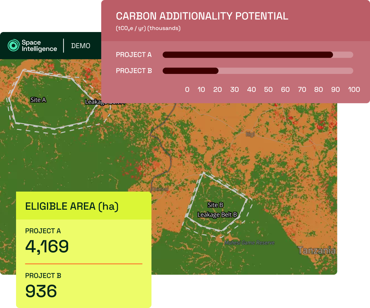
Screen opportunities quickly and confidently
Upload a project boundary to our NbS Project Screening tool to assess the eligibility and carbon impact potential of projects against carbon standard methodologies within minutes.
- Eligibility analysis against carbon standard methodologies
- Estimated carbon impact over the project lifetime
- From upload to results in <2 minutes
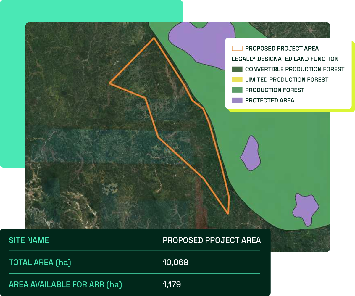
Give investors confidence in pre-issuance project potential
We combine our geospatial analysis and carbon project expertise to produce robust Technical Pre-Feasibility Assessments of your project to help you provide eligibility confirmation and carbon credit estimates in support of your fundraising and construction of your PDD.
- Eligibility assessment against specified methodology
- Ex-ante estimates of carbon impact
- Land cover dynamics to support assessments of Leakage and other project risks
- Analysis underpinned by our audit-grade land cover data
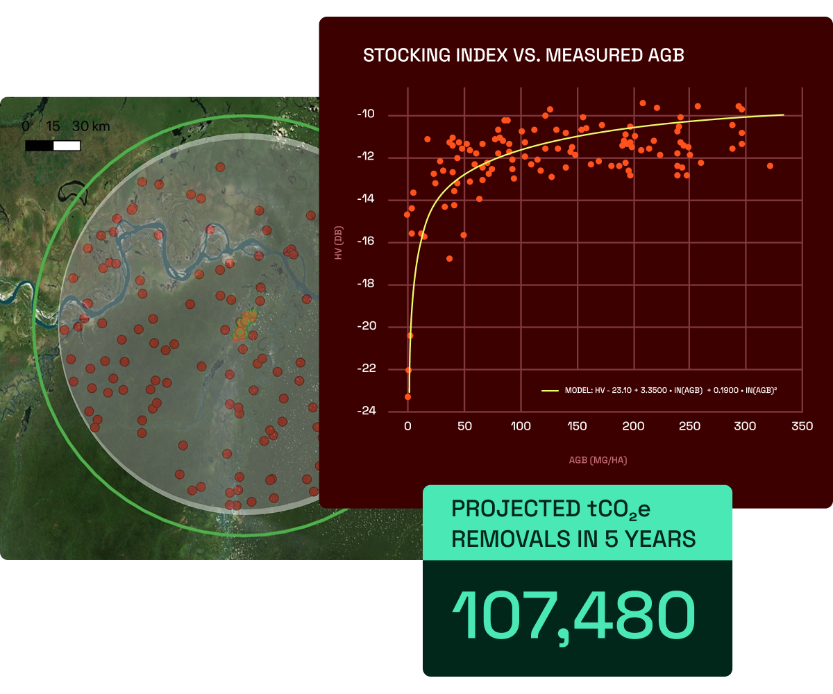
Project baseline and MRV support
We support developers with audit-grade mapping data and services to generate or verify baselines across any carbon standard, with a proven track record of guiding projects through audit.
- Baselining for VM0047, VM0048, VM0010, VM0033
- Monitoring period reporting
- Bespoke auditing support
Protect & showcase project impact
Our project monitoring service goes beyond basic MRV to provide project developers with performance insights they can trust, action, and share with stakeholders to communicate impact.
- Assessments of leakage, additionality, and ex-post credit integrity
- Biodiversity health indicator monitoring, including habitat fragmentation
- Quarterly degradation and deforestation event monitoring
Why work with Space Intelligence?
Data transparency & consistency
Our carbon insights and tools are underpinned by industry-leading geospatial datasets; so you can have trust and consistency in how you evaluate projects.
Your partner across your program
We can help you navigate the evolving landscape of standards and methodologies with our team of carbon standard experts to go above and beyond just dMRV.
Proven experience in the VCM
We are proud to work with leaders in the NbS space, including being an official Verra data provider for the production of VM0048 baselines.
How to work with Space Intelligence
Our packages are flexible to meet your needs, whether it’s a one-off assessment for project issuance or ongoing monitoring and standards consultancy for your NbS program. Contact us to learn how we can help.