We provide audit-grade data and insights
that help you plan, develop, and report
on forest conservation and restoration initiatives.
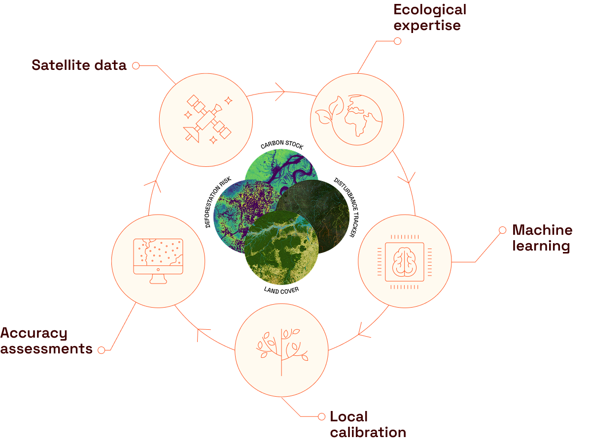
We combine satellite data analytics and carbon science expertise to deliver the highest quality nature mapping services for carbon markets and deforestation-free supply chain initiatives.
HOW WE HELP YOU
1/3
Build & monitor high integrity carbon project portfolios
We support developers, investors, and offtakers who are building portfolios of high impact NbS projects with end-to-end solutions that provide confidence in your NbS program claims.
We use our proprietary geospatial mapping datasets, technology stack, and carbon market expertise to support the assessment of your project’s technical feasibility, risks, performance, and impact, for both pre- and post-issuance.
We support frictionless, compliant trading of soft commodities under EUDR by producing audit-grade deforestation maps, delivered through the ICE Commodity and Traceability service (CoT).
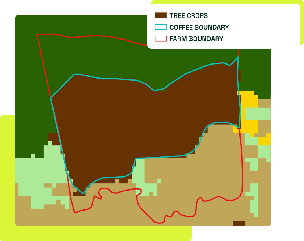
Using our coffee, cocoa and palm oil mapping data, we support organisations in generating higher accuracy Scope 3 emissions estimates from their supply chain.
Our products and services are backed by a unique combination of decades of expertise across geospatial analysis, carbon markets, ecology, and machine learning to ensure you have data & insights you can rely on.
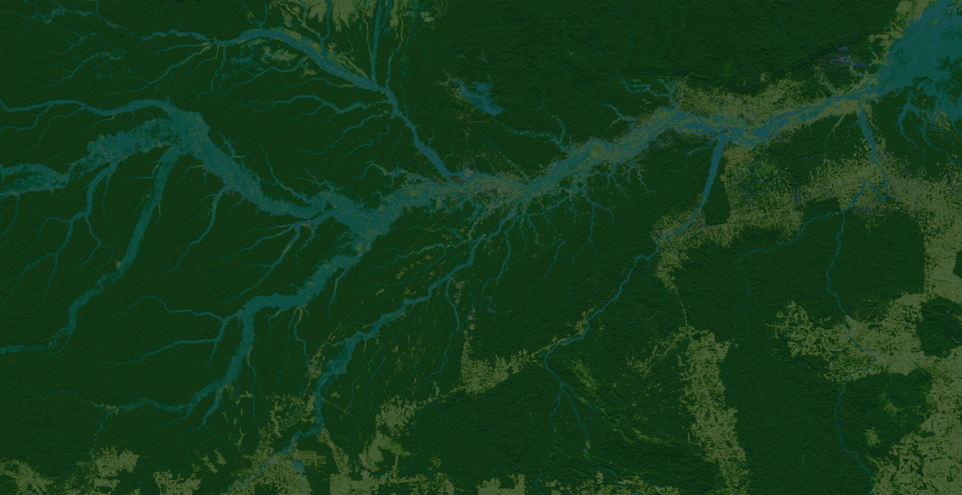
We operate globally, but think locally: we produce audit-grade mapping by using human-in-the-loop processes to ensure local calibration and training of our machine learning algorithms that help us produce accuracy at scale.
We underpin integrity across carbon and compliance markets
Trusted by nature leaders
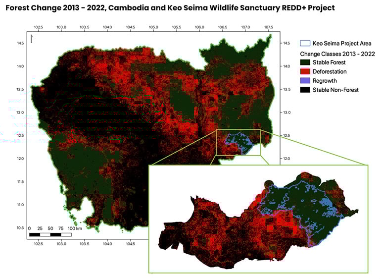
The Keo Seima Wildlife Sanctuary REDD+ Project is an area of dry seasonal forest within Cambodia. We’ve been on the ground and we’ve seen the absolute destruction of forests around the project. But the open source, uncalibrated data just wasn’t quite showing it.
Once Space Intelligence mapped the area we were able to confirm that the surrounding area has been nearly completely devastated through the conversion of forests to agriculture, plantations and bare land. They did a really detailed, deep dive to ensure that the models were calibrated to suit those different types of land classes within that environment.